
 Photo: Soundarya Varadarajan · CC BY-SA 3.0
Udaipur distance chart: road distances to day trips, cities and sights
Udaipur is about 97 km from Kumbhalgarh, 47 km from Nathdwara, 160 km from Mount Abu, 257 km from Jodhpur and 395 km from Jaipur by road, measured from the City Palace in October 2026. Car times, conservative on purpose, run from 1 hr 15 min to 7 hr 30 min for those five. The tables below give every pair.
- Kumbhalgarh
- about 97 km, 2 hr 30 min
- Nathdwara
- about 47 km, 1 hr 15 min
- Mount Abu
- about 160 km, 4 hr
- Jaipur
- about 395 km, 7 hr 30 min
- Measured
- 30 October 2026, OpenStreetMap data
Updated By Hotel Rudra Kripa9 min read
Most pages that answer “Udaipur to Kumbhalgarh distance” give one number and no start point. This page gives the start point, the end point and the method, so you can tell why our figure differs from the next site’s. Every distance below was measured by road, between named points, on one day.
Each figure has two parts: kilometres, and a car time that errs on the long side. Treat both as “about”. Where a table says “City Palace” it means the main gate, Badi Pol. “Hotel” means Hotel Rudra Kripa in Sukher, north of the old city.
How far is each day trip from Udaipur?
Each row gives the figure from the City Palace and from the hotel. The start point matters less than people expect: for Kumbhalgarh the two figures differ by 8.0 km and 15 min.
| Place | From City Palace | From hotel |
|---|---|---|
| Eklingji Temple, Kailashpuri | 23 km, 1 hr | 14.8 km, 40 min |
| Sas Bahu temples, Nagda | 24 km, 1 hr 5 min | 15.8 km, 45 min |
| Shrinathji Temple, Nathdwara | 47 km, 1 hr 15 min | 39 km, 1 hr |
| Statue of Belief, Nathdwara | 46 km, 1 hr 10 min | 38 km, 1 hr |
| Haldighati | 42 km, 1 hr 10 min | 44 km, 1 hr 10 min |
| Chetak Smarak, Haldighati | 41 km, 1 hr 10 min | 43 km, 1 hr 5 min |
| Sanwaliya Seth Temple, Mandaphiya | 88 km, 2 hr 15 min | 86 km, 2 hr 10 min |
| Chittorgarh Fort | 119 km, 3 hr | 118 km, 3 hr |
| Kumbhalgarh Fort | 97 km, 2 hr 30 min | 89 km, 2 hr 15 min |
| Rajsamand Lake | 65 km, 1 hr 40 min | 57 km, 1 hr 30 min |
| Jaisamand Lake | 54 km, 1 hr 25 min | 60 km, 1 hr 35 min |
| Ranakpur Jain Temple | 90 km, 2 hr 15 min | 87 km, 2 hr 15 min |
| Jawai Bandh village | 125 km, 3 hr 10 min | 122 km, 3 hr 5 min |
| Mount Abu (Nakki Lake) | 160 km, 4 hr | 157 km, 4 hr |
| Dilwara Temples, Mount Abu | 161 km, 4 hr | 159 km, 4 hr |
Times are a planning figure, not a promise. A clear run is often quicker. For what each place is like, see our day trips guide, Kumbhalgarh Fort and Nathdwara.
How far are other cities from Udaipur?
Each city is measured from its main railway station (Mumbai Central, Jaipur Junction and so on) to the City Palace and the hotel, and back. Jodhpur is about 257 km from the City Palace and Jaipur about 395 km.
| City (station point) | To City Palace | To hotel | City Palace to city | Hotel to city |
|---|---|---|---|---|
| Ajmer | 264 km, 5 hr 30 min | 258 km, 5 hr 30 min | 265 km, 5 hr 30 min | 257 km, 5 hr 30 min |
| Jaipur | 396 km, 7 hr 30 min | 389 km, 7 hr 30 min | 395 km, 7 hr 30 min | 388 km, 7 hr 30 min |
| Jodhpur | 257 km, 5 hr 30 min | 251 km, 5 hr 30 min | 257 km, 5 hr 30 min | 249 km, 5 hr 30 min |
| Bhilwara | 155 km, 4 hr | 148 km, 3 hr 45 min | 155 km, 4 hr | 147 km, 3 hr 45 min |
| Kota | 285 km, 6 hr | 283 km, 6 hr | 285 km, 6 hr | 283 km, 6 hr |
| Ahmedabad | 251 km, 5 hr 30 min | 261 km, 5 hr 30 min | 250 km, 5 hr 30 min | 260 km, 5 hr 30 min |
| Vadodara | 304 km, 6 hr | 314 km, 6 hr 30 min | 304 km, 6 hr | 315 km, 6 hr 30 min |
| Rajkot | 472 km, 8 hr 30 min | 482 km, 8 hr 30 min | 472 km, 8 hr 30 min | 482 km, 8 hr 30 min |
| Surat | 436 km, 8 hr | 446 km, 8 hr | 439 km, 8 hr | 449 km, 8 hr |
| Indore | 437 km, 8 hr | 447 km, 8 hr | 435 km, 8 hr | 445 km, 8 hr |
| New Delhi | 681 km, 11 hr 30 min | 674 km, 11 hr 30 min | 674 km, 11 hr 30 min | 666 km, 11 hr 30 min |
| Mumbai | 707 km, 12 hr | 717 km, 12 hr | 709 km, 12 hr | 720 km, 12 hr |
| Pune | 829 km, 13 hr 30 min | 839 km, 14 hr | 831 km, 13 hr 30 min | 841 km, 14 hr |
Mumbai, Pune, Surat and part of the Delhi route use expressways as OpenStreetMap maps them, and we could not confirm that every section is open. Check the current route in a live maps app before a long drive. The Indore figure is the fastest highway route; the section on disagreeing figures below says why published figures for it may differ.
Distances between Udaipur’s main sights
Read from the sight in the left column to the one at the top. The two directions can differ, because of one-way streets, so each cell is from the row to the column.
| From \ to | City Palace | Gangaur Ghat | Jagdish Temple | Bagore Ki Haveli | Fateh Sagar Lake | Saheliyon Ki Bari | Sajjangarh gate | Shilpgram |
|---|---|---|---|---|---|---|---|---|
| City Palace | – | 0.5 km, 5 min | 0.2 km, 5 min | 0.5 km, 5 min | 3.6 km, 10 min | 3.1 km, 10 min | 4.1 km, 15 min | 6.6 km, 20 min |
| Gangaur Ghat | 0.5 km, 5 min | – | 0.4 km, 5 min | 0.0 km, 5 min | 3.8 km, 15 min | 3.3 km, 10 min | 3.8 km, 10 min | 6.8 km, 20 min |
| Jagdish Temple | 0.2 km, 5 min | 0.4 km, 5 min | – | 0.4 km, 5 min | 3.5 km, 10 min | 2.9 km, 10 min | 4.0 km, 15 min | 6.5 km, 20 min |
| Bagore Ki Haveli | 0.5 km, 5 min | 0.0 km, 5 min | 0.4 km, 5 min | – | 3.8 km, 15 min | 3.3 km, 10 min | 3.8 km, 10 min | 6.9 km, 20 min |
| Fateh Sagar Lake | 3.7 km, 10 min | 3.8 km, 15 min | 3.5 km, 10 min | 3.9 km, 15 min | – | 1.5 km, 5 min | 6.0 km, 20 min | 5.0 km, 15 min |
| Saheliyon Ki Bari | 3.1 km, 10 min | 3.3 km, 10 min | 3.0 km, 10 min | 3.3 km, 10 min | 1.5 km, 5 min | – | 6.6 km, 20 min | 3.5 km, 10 min |
| Sajjangarh gate | 4.1 km, 15 min | 3.7 km, 10 min | 4.0 km, 15 min | 3.8 km, 10 min | 5.5 km, 15 min | 6.0 km, 20 min | – | 3.7 km, 10 min |
| Shilpgram | 6.6 km, 20 min | 6.8 km, 20 min | 6.4 km, 20 min | 6.8 km, 20 min | 5.0 km, 15 min | 3.5 km, 10 min | 3.7 km, 10 min | – |
Sajjangarh is measured to the gate, not to the Monsoon Palace at the top. For visiting details see Lake Pichola, Shilpgram and the City Palace.
From the airport and the railway station to the sights
Maharana Pratap Airport (Dabok) and Udaipur City railway station reach the sights from different sides of the city. The City Palace is about 24 km, 1 hr 5 min from the airport and about 4.0 km, 15 min from the station. For the full journey options see how to reach Udaipur.
| Destination | From airport | From Udaipur City station |
|---|---|---|
| Hotel Rudra Kripa | 22 km, 1 hr | 13.2 km, 35 min |
| City Palace | 24 km, 1 hr 5 min | 4.0 km, 15 min |
| Gangaur Ghat | 24 km, 1 hr 5 min | 4.2 km, 15 min |
| Jagdish Temple | 24 km, 1 hr 5 min | 3.8 km, 10 min |
| Bagore Ki Haveli | 24 km, 1 hr 5 min | 4.2 km, 15 min |
| Fateh Sagar Lake | 25 km, 40 min | 5.6 km, 15 min |
| Saheliyon Ki Bari | 25 km, 1 hr 5 min | 5.1 km, 15 min |
| Sajjangarh gate | 29 km, 45 min | 8.8 km, 25 min |
| Shilpgram | 27 km, 45 min | 8.7 km, 25 min |
The time rule steps once at 25 km, where city driving gives way to highway, so a route just over that line can read shorter than one just under it: 24.97 km reads 65 min and 25.00 km reads 40 min. Do not compare times across that line; compare the kilometres.
How these distances were measured
- Data and router
- OpenStreetMap road data, routed by car with OSRM (router.project-osrm.org), using its fastest route, on 30 October 2026.
- Start and end points
- Each place has one arrival point: a station forecourt, the terminal kerb, a gate, a ghat or a temple entrance. Each is a named point on the map. The hotel point is its Google Maps pin.
- Pairs
- All pairs among the places in and around Udaipur, both ways. Each city only to and from the hotel, the City Palace and Udaipur City station.
- Kilometres
- One decimal under 20 km; whole kilometres from 20 km.
- Minutes, under 25 km
- The longer of OSRM’s time × 1.6 and km × 2.6 (about 23 km/h), rounded up to the next 5 minutes.
- Minutes, 25 km to under 150 km
- The longer of OSRM’s time × 1.3 and km × 1.5 (40 km/h), rounded up to the next 5 minutes.
- Minutes, 150 km and over
- The first 150 km at 40 km/h and the rest at about 70 km/h (225 min plus km beyond 150 × 0.85), or OSRM’s time × 1.3 if longer, rounded up to the next 30 minutes.
The aim is that a longer highway route never reads quicker than a shorter one. Real times vary with traffic, the time of day and festivals. The figures were measured once and are not a live feed.
Why other websites give different distances
Most sites do not say how they measured, so there is no way to compare. These are the causes we found in the published figures.
- Different start points. “Udaipur” may mean the City Palace, a bus stand, a station or the city boundary.
- Different end points. Jawai Bandh is measured here to the village. Published figures for Jawai differ, and many sites do not say where they end.
- Different routes. Our Indore figure is the fastest highway route, about 437 km to the City Palace. Some published figures are shorter, which suggests slower roads.
- Disagreeing sources. For the airport, Wikipedia says about 22 km east of the city and Rajasthan Tourism says about 25 km north-east of the centre. For Kumbhalgarh to Ranakpur we measure 34 km, and published figures vary widely.
- Time assumptions. Our times are conservative on purpose, so they will often read longer than a map app’s.
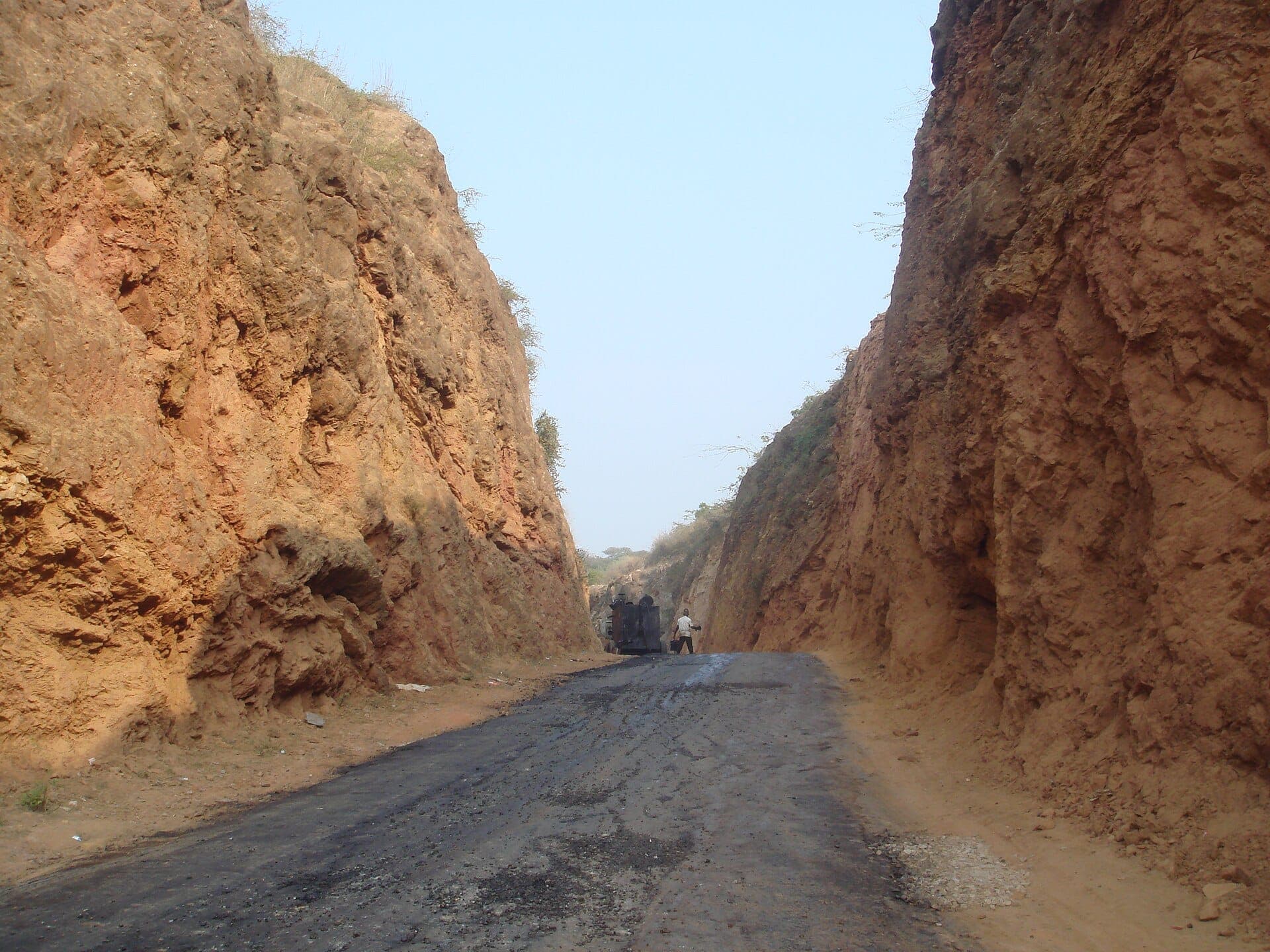 Photo: Soundarya Varadarajan · CC BY-SA 3.0
Haldighati is about 42 km, 1 hr 10 min from the City Palace. Sanwaliya Seth Temple at Mandaphiya is about 88 km, 2 hr 15 min, and Jawai Bandh village about 125 km, 3 hr 10 min.
Using this data
You are welcome to quote these figures if you link to this page (hotelrudrakripa.com/udaipur/distances) and keep the credit: © OpenStreetMap contributors. The underlying road data is available under the Open Database Licence. Say “about”, and say they were measured on 30 October 2026 from the points described above. How we gather and date facts for the other guides is explained in how we write our guides.
These are measurements, not a promise of journey time. Check a live maps app on the day. Roads change, and these figures will change when they are measured again.
Questions & answers
How far is Udaipur from Kumbhalgarh?
About 97 km by road from the City Palace, around 2 hr 30 min by car on our conservative times. From Hotel Rudra Kripa in Sukher it is about 89 km.
How far is Udaipur from Nathdwara?
About 47 km by road from the City Palace to the Shrinathji Temple, around 1 hr 15 min by car. A clear run is often quicker.
How far is Udaipur from Mount Abu?
About 160 km by road from the City Palace to Nakki Lake, around 4 hr by car.
How far is Udaipur from Jaipur?
About 395 km by road from the City Palace to Jaipur Junction, around 7 hr 30 min by car.
How far is Udaipur from Jodhpur?
About 257 km by road from the City Palace to Jodhpur Junction, around 5 hr 30 min by car.
How far is Udaipur from Sanwaliya Seth and Jawai?
Sanwaliya Seth Temple at Mandaphiya is about 88 km from the City Palace. Jawai Bandh village is about 125 km, measured to the village rather than to safari lodges.
Why do other websites give different distances?
They start and end at different points or choose different routes, and most do not say which. Our points, router and rounding rule are stated on this page.
Sources
- OSRM routing demo serverthe router used for every figure; fastest car route. Read 30 October 2026.
- OpenStreetMap copyright and licenceroad data and the credit it asks for; undated. Read 30 October 2026.
- Maharana Pratap Airport, Wikipediareported airport distance, about 22 km. Read 30 October 2026.
- Udaipur, Rajasthan Tourismreported airport distance, about 25 km north-east of the centre; undated. Read 30 October 2026.
Fees and hours change, so check them before you go. How these guides are made: how we write our guides. Spotted something out of date? Email info@hotelrudrakripa.com.
Keep planning
Staying in Udaipur?
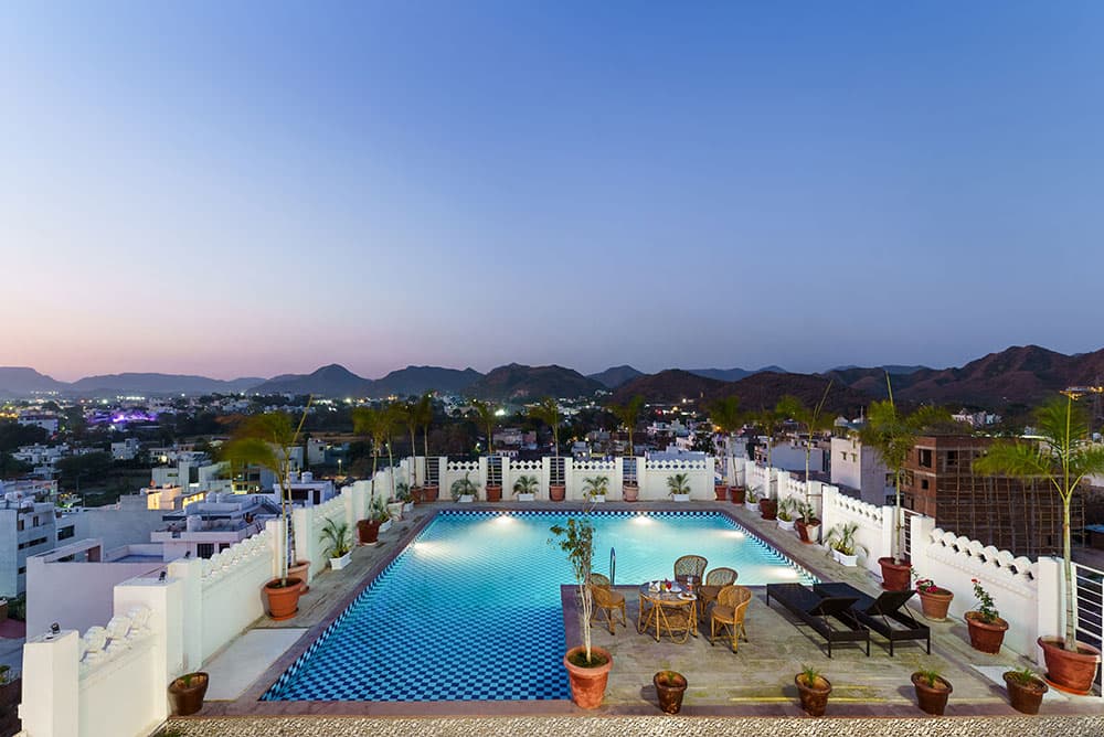
Hotel Rudra Kripa is in Sukher, north of the old city and about 9.2 km by road from the City Palace, with a rooftop pool, a restaurant and free parking. Send us your dates and the reservations team will reply with availability, or call or WhatsApp the hotel.